For those passionate about ecotourism and adventure travel, holidays are always a great opportunity to explore and reconnect with nature. According to a recent survey by Instituto Semeia, hiking trails are among the most sought-after activities, representing the interest of 36% of visitors to conservation units.
Brazil, besides being rich in biodiversity, is also generous when it comes to holidays, with an average of 4 to 6 long weekends per year. And since we are, according to Forbes, the best country in the world for ecotourism, we have the perfect combination to fully dive into this activity.
With that in mind, I’ve selected 10 trail options, with varying levels of difficulty and experiences, to help you choose your next adventure. Shall we?
1. Calçada do Lorena
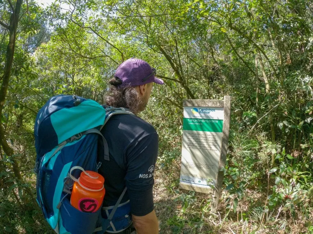
Photo: Informative sign – Projeto Parques Nacionais archive
Located in the metropolitan region of São Paulo, in the municipality of São Bernardo do Campo, Calçada do Lorena is a 3.5 km trail that crosses the Parque Estadual da Serra do Mar, specifically in the Caminhos do Mar sector.
Amidst the lush Atlantic Forest, the trail features sections paved with stones dating back to the 18th century. It was the first paved route connecting the plateau to the São Paulo coast, used during colonial times for transporting goods.
Ideal for beginners, the trail is well-marked, relatively short, and offers the option to return via the old Estrada Velha de Santos — Brazil’s first concrete-paved highway — which passes by historical monuments dating back to 1922.
This trail provides a unique experience by blending the rich nature of Serra do Mar with the country’s history.
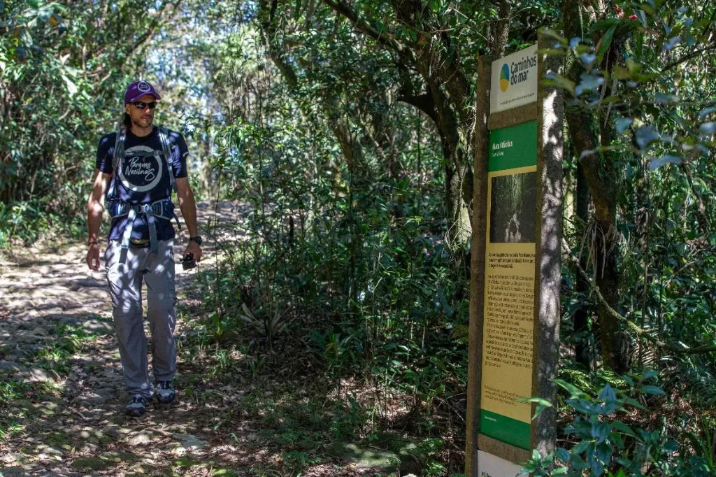
Photo: Walking the Calçada – Projeto Parques Nacionais archive
2. Pedra do Altar + Circuito dos Cinco Lagos (optional)
Photo: Pedra do Altar – Projeto Parques Nacionais archive
Pedra do Altar is one of the most iconic trails in the high-altitude section of the Parque Nacional do Itatiaia, located on the border between the states of Rio de Janeiro and Minas Gerais, specifically in the municipalities of Itatiaia (RJ) and Itamonte (MG).
The trail starts at the high-section entrance, also known as Posto Marcão, and continues toward Abrigo Rebouças. It begins with a gentle descent along the road, offering stunning views of Morro do Couto, Agulhas Negras, and Pedra do Altar itself — forming a breathtaking mountainous landscape that feels almost surreal.
From Abrigo Rebouças, it’s another 3 km to reach the summit of Pedra do Altar. The second part of the trail, which passes by the base of Agulhas Negras, features a steady incline. As you gain elevation, the landscape transforms, and the vast plateau draws your attention at every rest stop. Soon you’ll spot the Prateleiras on the opposite side and, further along, the Asa de Hermes.
Although it’s a demanding trail, it is not technically difficult, making it accessible to anyone with at least basic physical preparation. The main highlight is the 360º panoramic view of the park, offering a truly immersive nature experience.
The return can be done via the same path, but for those who want a longer hike and an alternative route, there is the option of returning via the 5 Lakes Circuit. This path starts at the fork at the base of the Altar trail and ends near Posto Marcão.
Without a doubt, it will be an unforgettable and immersive experience in Brazil’s first national park.
Photo: At the summit of Pedra do Altar with Asa de Hermes in the background – Projeto Parques Nacionais archive
3. Pico do Baepi Trail
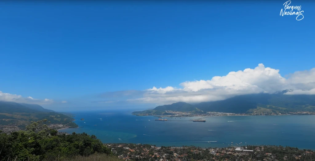
Photo: Panoramic view on the ascent – Projeto Parques Nacionais archive
The trail to Pico do Baepi (“bald mountain” in Tupi-Guarani) is one of the most traditional in Ilhabela and a true challenge for adventurers. Many are unaware that around 85% of Ilhabela is protected by the Parque Estadual de Ilhabela, located in São Sebastião, on the northern coast of São Paulo state.
This trail is a favorite among visitors looking to explore the preserved Atlantic Forest of the region and enjoy a unique view of the island.
With approximately 7.5 km round trip, the trail requires good physical conditioning due to the constant uphill. It begins in an open area and soon reaches a viewpoint offering stunning views of the Ilhabela Channel. As the trail enters the forest, it becomes narrower and more demanding, with sections of wooden stairs where hand support is necessary for balance. The final stretch is steeper and includes a wooden handrail to aid the ascent.
At the summit, you’re rewarded with a breathtaking panoramic view from 1,048 meters above sea level, overlooking the Ilhabela archipelago and the surrounding ocean.
It’s important to note that hiring certified guides is mandatory. Starting early in the day is also recommended, as the heat and humidity can be intense.
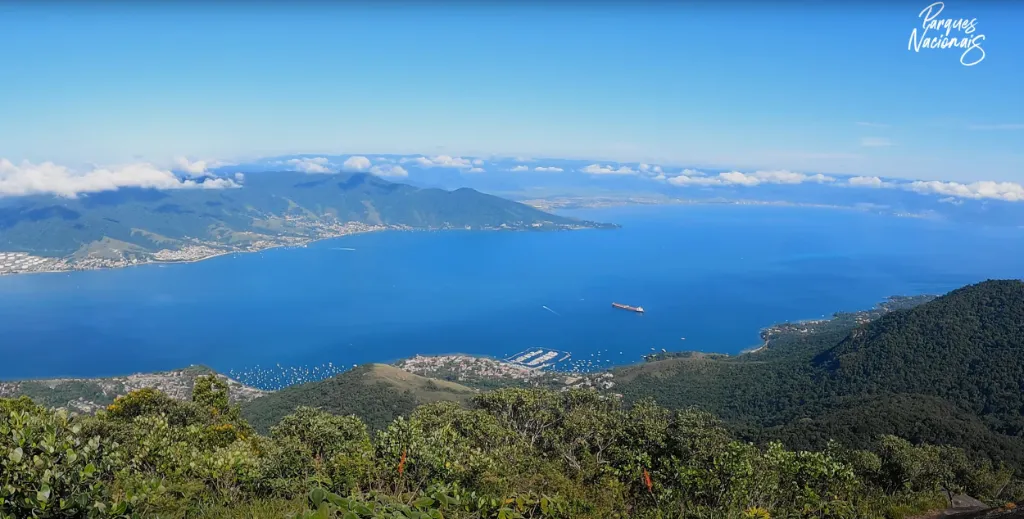
Photo: Panoramic view from the top of Pico do Baepi – Projeto Parques Nacionais archive
4. Arco do André Trail
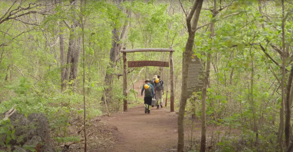
Photo: Trailhead portal – Projeto Parques Nacionais archive
This is the longest trail in the still lesser-known Parque Nacional Cavernas do Peruaçu, located in Januária (MG). The park is in an ecotone area – a transition zone between the cerrado and caatinga biomes – resulting in striking, colorful landscapes.
With around 10 km in length, the loop trail is recommended for more experienced adventurers. Along the way, several highlights catch the eye, such as the Mirante do Mundo Inteiro, offering an impressive view of the Peruaçu River, which carved the region’s canyons and caves.
The trail’s highlight is the Arco that gives it its name – a subterranean passage with massive walls in terracotta tones, making visitors feel as small as ants.
In addition, the trail includes narrow passages, bridges, and wooden staircases and provides access to two more fascinating caves: Lapa do Cascudo and Lapa dos Troncos, enhancing the diversity and excitement of the experience.
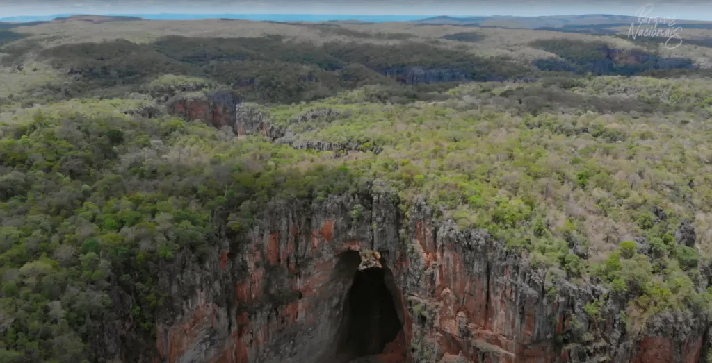
Photo: Aerial view of Arco do André – Projeto Parques Nacionais archive
5. Cachoeira do Fundão Trail
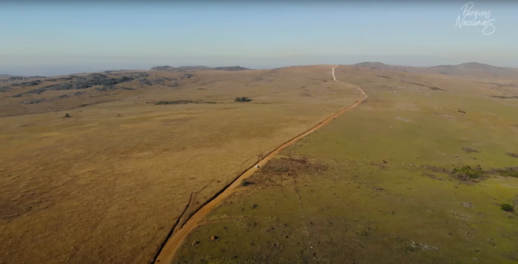
Photo: Aerial view of the highland fields – Projeto Parques Nacionais archive
This is a classic hike in the Parque Nacional da Serra da Canastra, offering a unique experience immersed in lush nature.
The park’s main entrance, known as Portaria 1, is located in São Roque de Minas (MG). From there, the trail to Cachoeira do Fundão is accessed. After about 40 km by car along the park road, you’ll park in a designated area and continue with a 6 km hike to reach the waterfall.
The trail is of easy difficulty, though relatively long. It’s well-marked and divided into two parts: the first along a dirt road and the second through an inner forest trail, crossing rivers and rocky obstacles.
As you hike, the waterfall becomes visible, with its impressive 40-meter drop – an extra motivation to keep going. Upon arrival, a deep emerald pool invites you for a swim.
Due to the long distances both on foot and by car, the site remains well preserved, as few visitors venture there – making the experience even more exclusive.
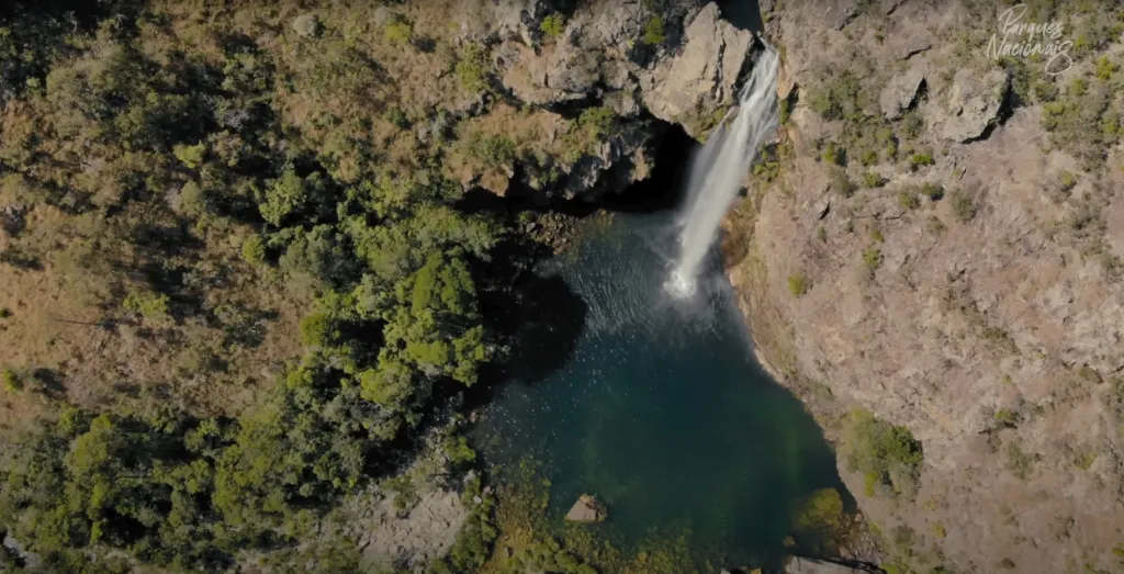
Photo: Aerial view of Cachoeira do Fundão – Projeto Parques Nacionais archive
6. Farol das Conchas Trail
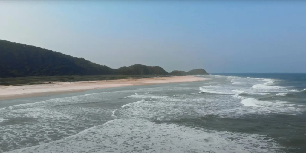
Photo: Aerial view of Praia Grande – Projeto Parques Nacionais archive
This trail suggestion is actually a great opportunity to explore one of the most iconic destinations in Paraná State: Ilha do Mel. It’s worth noting that 93% of the island is protected by two conservation units: an Ecological Station and a State Park.
Located 120 km from Curitiba, there are several ways to reach the island, offering different journey durations and scenic routes. You can opt for a charming drive along Serra da Graciosa, take a scenic train ride through the Serra do Mar to Morretes, or follow the faster BR-277 route to Paranaguá or Pontal do Sul, from where boats depart to Ilha do Mel.
Upon arriving at Ilha do Mel, starting from Praia de Encantadas – one of the island’s main disembarkation points – you’ll enjoy a peaceful 2-hour walk through nearly deserted, uniquely beautiful beaches such as Praia do Cano, Praia do Miguel, Praia Grande, and Praia de Fora. Along the way, you’ll need to cross a few hills until you reach Morro do Farol, where a staircase leads to the top. From there, you can admire a stunning view of the island, including the isthmus – a narrow strip of land separating the calm bay from the open sea.
The landscape is so well preserved it evokes the scenery Portuguese explorers found 500 years ago, offering a unique experience of connection with nature.
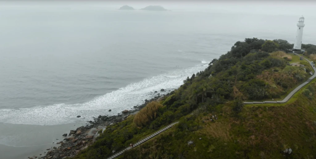
Photo: Aerial view of Farol das Conchas – Projeto Parques Nacionais archive
7. Pedra da Macela Trail
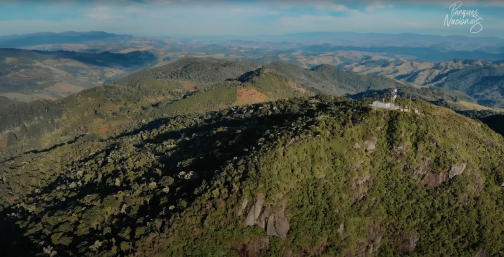
Photo: Aerial view of Pedra da Macela – Projeto Parques Nacionais archive
Pedra da Macela, located in the municipality of Cunha (SP), is one of the main attractions of the Parque Nacional da Serra da Bocaina. Access is via the Parati-Cunha road (SP-171), at KM 66. From there, you’ll drive 4.5 km on a dirt road to the park entrance.
The trail to the summit follows a paved road of about 2.5 km with a constant incline and 400 meters of elevation gain. It can be completed in roughly 2 hours at a relaxed pace.
At 1,840 meters of altitude, the views are breathtaking. From the first viewpoint, you can admire the mountains of the Paraíba Valley. From the main viewpoint, a panoramic vista opens over the Serra do Mar, and in the distance, the bays of Paraty and Angra dos Reis – a truly unique landscape.
The park has two free camping areas. One is near the entrance, and the other is farther away, near the Pedra da Macela viewpoints. These are excellent options for those seeking a more immersive experience – especially for sunrise seekers. Watching the sun rise over the ocean from the mountaintop is a rare and unforgettable sight.
Another highlight is the refreshing streams near the entrance, ideal for a dip after the hike. The park also provides dry toilets for visitors, offering more comfort for those spending the day or camping.
Photo: Aerial view of the bay of Paraty and Angra dos Reis – Projeto Parques Nacionais archive
Check Instagram for opening hours and camping details
8. Pico da Bandeira Trail
Photo: View of Pico da Bandeira from the Espírito Santo side trail – Projeto Parques Nacionais archive
Pico da Bandeira, standing at 2,891 meters, is Brazil’s third-highest peak. It’s located in the Parque Nacional do Caparaó, on the border between the states of Minas Gerais and Espírito Santo. The park has two main access points, one in each state: Alto Caparaó (Minas Gerais) and Dores do Rio Preto (Espírito Santo).
You can reach Pico da Bandeira in different ways: as a day hike, with camping, or via a full crossing. Each entrance offers a main trail to the summit. From Espírito Santo, the trail is 4.5 km one way with 600 meters of elevation gain. From Minas Gerais, the trail is 6.5 km one way with 900 meters of elevation gain.
If you plan to camp, the park offers two camping areas on each side. On the Minas side: Tronqueira and Terreirão. On the Espírito Santo side: Casa Queimada and Macieira.
Regardless of the chosen route, the climb provides an incredible mountaineering experience. The high altitude means rocky outcrops and spectacular views of the Caparaó range. The trails aren’t technical but require good fitness due to the elevation and constant uphill. It’s an ideal hike for beginners in mountaineering seeking to conquer one of Brazil’s highest peaks.
One of the most popular experiences is hiking to the summit to watch the sunrise. To do this, hikers must begin in the early morning hours, as overnight camping at the summit is prohibited. This experience is physically demanding and should only be attempted by experienced mountaineers. For beginners, hiring a certified guide is strongly recommended.
Camping must be reserved in advance. Avoid visiting on holidays and high-season weekends when the park is most crowded. Each entrance has a visitor and camping capacity, so planning is key.
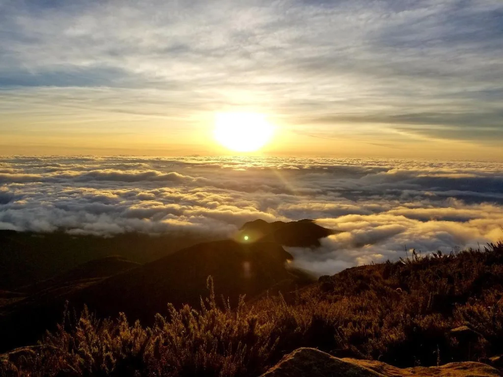
Photo: Sunrise from the summit of Pico da Bandeira – Projeto Parques Nacionais archive
9. Janela do Céu Circuit Trail
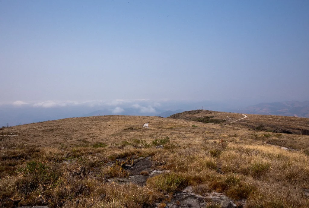
Photo: Rocky grasslands of the park – Projeto Parques Nacionais archive
Located in Parque Estadual do Ibitipoca, in the municipality of Lima Duarte (MG), this trail is a true surprise thanks to its variety of landscapes and the number of attractions along the way.
Amidst the Atlantic Forest, with numerous rocky outcrops and features typical of rupestral grasslands, the trail reveals countless opportunities for swimming in rivers and waterfalls. The waters, with their caramel hue, are always inviting.
The 16 km circuit route is demanding, with steep ascents and descents. It’s essential to dedicate a full day to the hike and to be well-prepared with food and drinking water. Good physical conditioning is also important due to the long-distance and challenging terrain.
Along the trail, visitors will encounter several highlights, such as the Lombada — the park’s highest point at 1,784 m — some caves, and the Janela do Céu. This is a canyon that ends in a dramatic waterfall drop, offering a breathtaking view of the valley. The surrounding vegetation frames the scene like a window, which inspired the name “Window to the Sky.”
During holidays, the site often becomes crowded, with lines to access the main viewpoints. A great tip in such cases is to spend more time at Cachoeirinha, a charming waterfall that flows over rocks into a perfect natural pool for a refreshing swim.
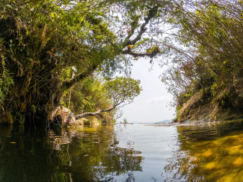
Photo: View of Janela do Céu – Projeto Parques Nacionais archive
10. Yellow Trail (Saltos, Carrossel and Corredeiras)
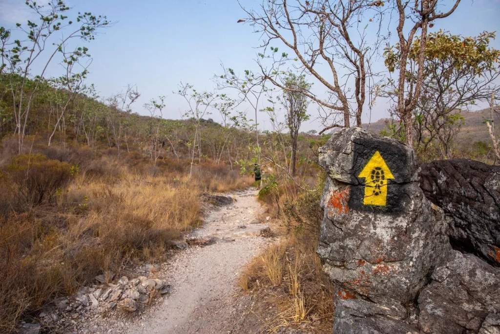
Photo: Yellow Trail signage – Projeto Parques Nacionais archive
The Yellow Trail at Parque Nacional da Chapada dos Veadeiros is a fantastic option for those who want to explore the heart of the cerrado biome. The trail features stunning landscapes, flowing rivers, refreshing swims, and natural challenges with steep climbs and descents through rich and diverse flora.
Located in Goiás, in the village of São Jorge (part of the municipality of Alto Paraíso de Goiás), the park is about 250 km from Brasília.
The 11 km circular trail includes steep and rocky sections but is well-marked (part of the Brazilian trail network, indicated with black and yellow arrows) and can be hiked in either direction. The most common route is clockwise, offering a spectacular early view from the lookout over Salto do Rio Preto — the park’s iconic postcard image — with its impressive 120-meter free-fall waterfall. The hike ends at the relaxing natural pools and small falls of the Corredeiras do Rio Preto.
Along the way, there are several refreshing stops, such as Cachoeira do Garimpão (80 meters high), Cachoeira do Carrossel, and another viewpoint with stunning views of the Rio Preto canyons.
Without a doubt, this trail is a remarkable experience that will leave you wanting to return.
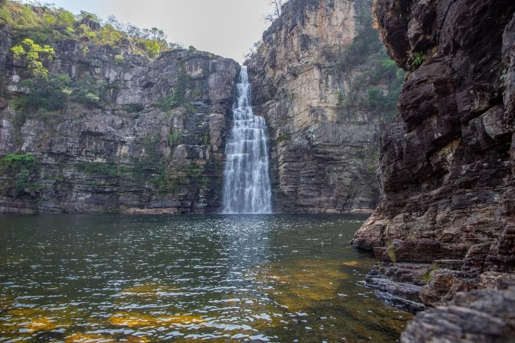
Photo: Cachoeira do Garimpão – Projeto Parques Nacionais archive
This post is also available in: Português (Portuguese (Brazil)) Español (Spanish)