

The Laugavegur trail is Iceland’s most popular, and it’s no coincidence. It spans 55 km between Landmannalaugar and Þórsmörk, crossing lava fields, glaciers, rivers, and colorful rhyolite mountains that look like they belong to another planet. For those seeking more adventure, you can still extend the route a bit further with the Fimmvörðuháls, which connects Þórsmörk to Skógar.
This guide brings together what we learned about logistics, accommodation, weather, and the practical details that make a difference when planning.
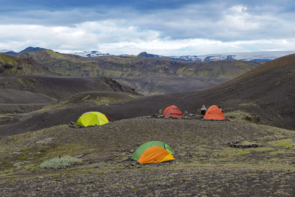
Campsite at Emstrur
Fact Sheet – Laugavegur – Iceland
- Location: Iceland
- Stages: 4 days
- Distance: 55 km
- Elevation gain: 1,600 m positive / 1,900 m negative
- Season: July-August
- Route type: Point to point
- Maximum altitude: 1,100m
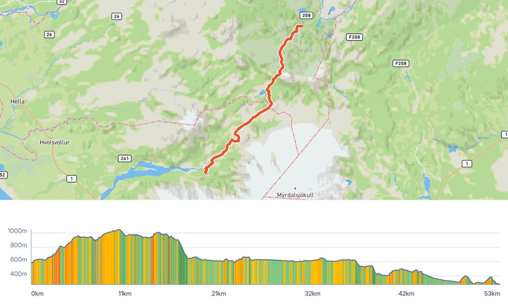
Overview map of the Laugavegur trail from the Hike Planner tool.
What to expect from the trail
The crossing is usually done in 4 days from north to south, between Landmannalaugar and Þórsmörk, but it’s also possible to extend it to 5 days, or shorten it to 3, for those already used to covering more distance per day. If you want to add the Fimmvörðuháls section, which connects Þórsmörk to Skógar, it’s best to add 2 more days; otherwise, it’s 26 km and 1,100 m of elevation gain to cover in just 1 day.
Already in Landmannalaugar you can enjoy one of Iceland’s most iconic landscapes, the colorful rhyolite mountains. It’s also a region with geothermal lakes, and right at the start of the trail there’s a hot spring pool accessible to those camping or staying at the hut. Along the trail, you’ll pass through more volcanic landscapes, lava fields, and geysers. The scenery, however, is quite diverse, and soon after you pass through green valleys with almost fluorescent colors, rivers everywhere, and a few waterfalls. At the end of the trail, in Þórsmörk, the landscape is one of rivers cutting through the whole valley, since the area sits at the base of two glaciers.
For those continuing on to Fimmvörðuháls, the trail leads to the Magni and Móði volcanic craters, formed in the 2010 eruption. This section also passes between the two glaciers Eyjafjallajökull and Mýrdalsjökull, creating an unmatched contrast of ice and fire. Right after passing the huts, the landscape starts to transform, going from an inhospitable climate to green fields full of life, majestic waterfalls, until ending in Skógar, home to the waterfall made famous by the show Vikings.
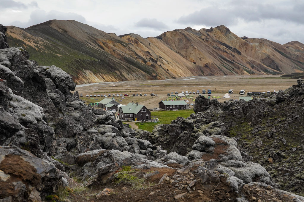
Landmannalaugar and the rhyolite mountains
How difficult is the Laugavegur?
The Laugavegur itself isn’t considered a difficult trail, either technically or physically, but Iceland’s unpredictable weather can complicate things quite a bit. Even though the trail doesn’t reach very high altitudes, the cold can be quite intense, mainly because of strong winds, which reach 70-80 km/h. For those camping, it’s important to pay extra attention when setting up and taking down the tent. It’s not uncommon to see tents flying away or having their frames broken because of strong wind. Use the extra guy lines to pitch the tent well, and always place some weight, like your backpacks, to help keep it on the ground.
Another challenge is river crossings. In some cases there are no bridges, which calls for extra care, since the current can be quite strong and the water can reach up to the knee. Many people bring their own sandals for wading through the rivers, so they don’t have to get their boots wet, since crossing barefoot isn’t recommended, as there’s more risk of hurting your foot or slipping on the rocks. Another tip is to use trekking poles for extra support on these sections. It’s worth looking up more specific tips on how to cross rivers with strong currents to get through these points more safely.
The Fimmvörðuháls section is somewhat more demanding, with a longer climb than the rest of the trail, with just over 1,000 m of elevation gain. The terrain is also a bit harder, as it crosses some lava fields and a stretch covered in snow. Visibility also tends to be poor at the highest point, requiring extra attention so as not to lose your way.
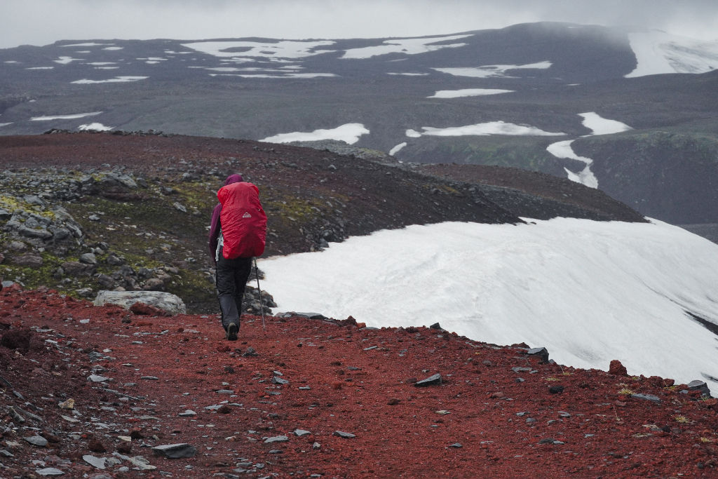
Contrast between volcanic terrain and glacier along the Fimmvörðuháls
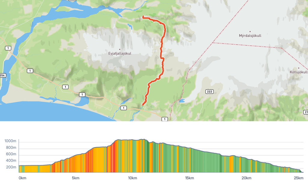
Overview map of the Fimmvorouhals trail from the Hike Planner tool.
How to get to the trailhead?
Reykjavik Excursions runs buses from the Icelandic capital to Landmannalaugar, Þórsmörk, and Skógar, so it doesn’t matter whether you’re doing the trail north to south, south to north, or including the Fimmvörðuháls. The important detail is that schedules are quite limited, basically one bus per day to each destination. It’s worth booking in advance on the Highland Bus website. The bus ride itself is already an adventure: the route to Landmannalaugar or Þórsmörk goes over quite rough roads, even crossing rivers.
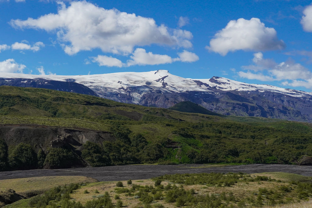
Views of the glacier from Þórsmörk
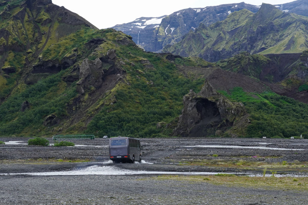
Bus from Þórsmörk
Where to sleep: huts and camping
Along the Laugavegur there are 8 huts up to Þórsmörk, 3 of them in the last stage. You can book a night at a hut or camp, since all the huts have a camping area alongside them. Wild camping is completely forbidden along the whole route, so it’s mandatory to use the official campsites next to the huts, which fortunately isn’t a problem, since they’re numerous and well distributed.
If you want to sleep inside the huts, you need to book in advance, and in that case you can only do the trail north to south. For those camping, as of this year a booking is also required, but you can still book in whatever order you like, which allows more flexibility and even lets you do the route in the opposite direction.
For those doing the Fimmvörðuháls, there are two hut options right in the middle of the way, at the trail’s highest point: Fimmvörðuskáli and Baldvinsskáli. The first has no water source, and the second, although it has water, has no showers. Camping is also allowed at these two spots, though it’s not recommended due to the harsh environment (lots of wind and extreme cold).
Something that surprised us: the huts, in general, don’t have cafés or restaurants, and don’t usually have covered areas for those camping. So if you get caught in rain or cold along the way, don’t count on a hut for shelter, unless you’ve booked a bed there. It’s important to plan well and bring food, since there isn’t always an option to buy along the way.
If you’re planning the details of each stage, it’s worth using Hike Planner to put together your itinerary with real route data, variants, huts with links for booking, plus downloading the GPX files for your navigation app.
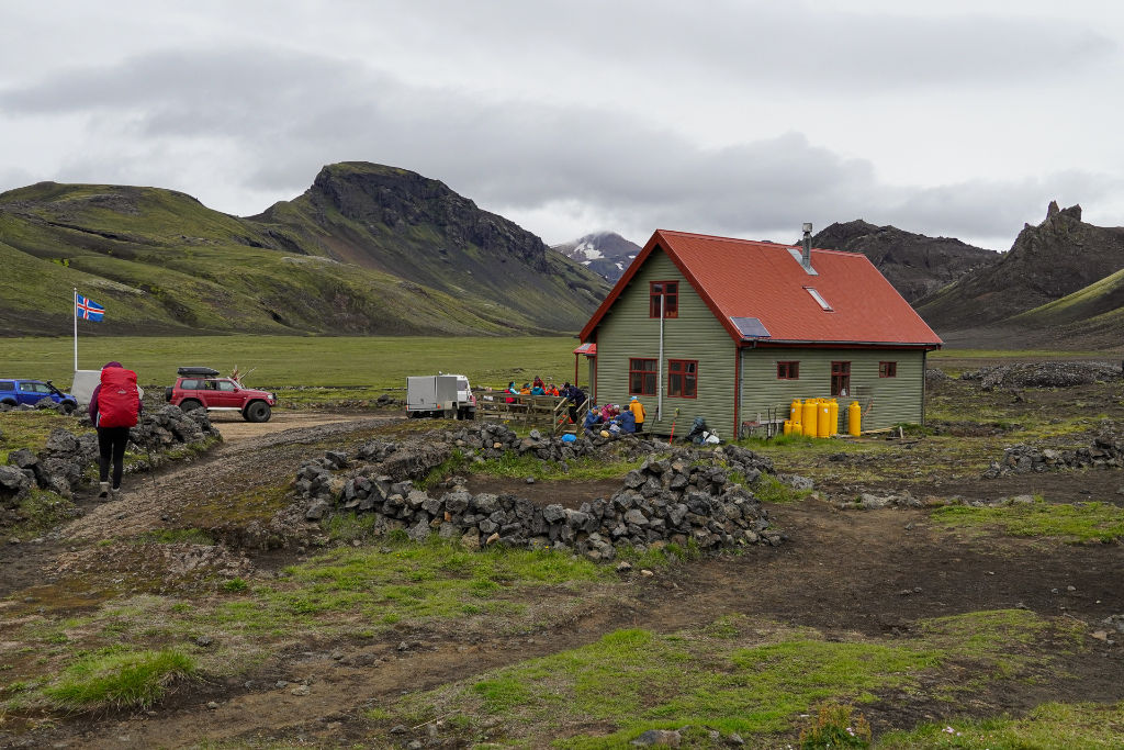
Hvannagil hut
What’s the best time of year?
The best months are July and August, and in general the huts stay open from late June until mid-September. Even though it’s summer, the weather can vary a lot. In a single day you can get sun and heat, cold, rain, and strong winds. You need to go prepared: dress in layers and wear wind- and rain-resistant pants, jackets, and gloves. Bringing a rain cover for your backpack is also important.
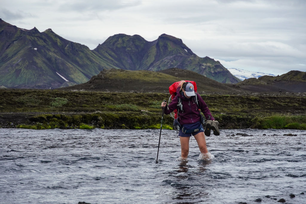
River crossing along the Laugavegur
Some practical tips for the Laugavegur trail
- River crossings are part of the experience. Bringing your own sandals for crossing the rivers can be a good idea.
- Plan your food for the whole route. There aren’t many options for restocking food along the way.
- Respect the signage and don’t leave the trail. The trail crosses fragile vegetation and unstable volcanic ground.
- Be prepared for all kinds of weather. As they say in Iceland, in a single day you can get four different seasons’ worth of weather.
- Bring a bottle with a water filter. You’ll pass by several rivers and water sources, but it’s recommended to filter before drinking.
- Bring cash. The local currency is the Icelandic króna (ISK), and it’s worth carrying some cash, including coins for the showers.
Where to start planning?
If you’ve made it this far and are excited to hike in Iceland, the next step is putting together your itinerary. Hike Planner is a perfect tool for planning your adventure. What sets it apart is the mapping of all accommodation options, all in one place, with all the contact details and links to make bookings.
The Laugavegur requires planning, but it doesn’t have to be complicated. With the right information and the right resources, you’ll arrive in Iceland ready to start, and you’ll understand why this trail is considered one of the most special on the planet.
For those who want to get a bit more of a feel for what it’s like to hike the Laugavegur, here’s a “Silent Hiking” style video with footage of the trail and camping:
This post is also available in: Português (Portuguese (Brazil)) Español (Spanish)