

The Anillo de Picos de Europa is a loop trek of about 68 miles (110 km) that crosses the park’s three major massifs, passing through Asturias, Castile and León, and Cantabria. The trail showcases the best of northern Spain, mixing green valleys with limestone walls, and passes through popular spots in the region such as the Ruta del Cares, the Lagos de Covadonga, Naranjo de Bulnes, and the refuge at the base of Pico Urriellu.
This guide brings together what we learned about logistics, lodging, water, weather, and the practical details that make a difference when planning.
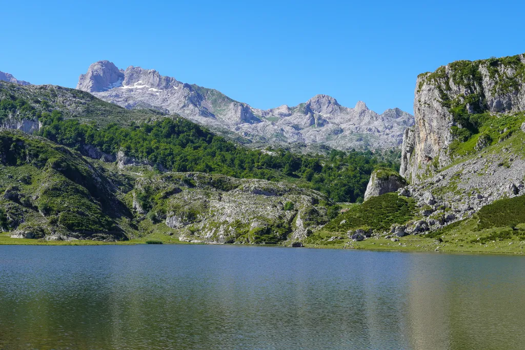
Lagos de Covadonga
Technical Specs: Anillo de Picos de Europa Trek
Location: Spain
Stages: 9 days
Distance: 71 mi (115 km)
Elevation: 28,215 ft (8,600 m) gain / 28,215 ft (8,600 m) loss
Season: June–September
Route type: Loop
Maximum elevation: 7,677 ft (2,340 m)
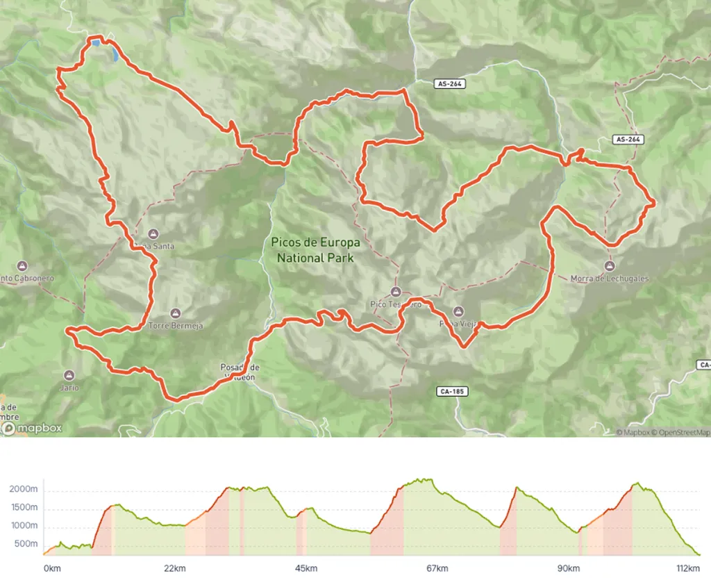
Overview map of the Anillo de Picos de Europa taken from the Hike Planner tool.
What to Expect on the Trail
The Anillo de Picos de Europa is rated as a difficult trail, not only physically but also technically. The trail markings are not beginner-friendly. You need to be comfortable identifying the trail on the ground and interpreting the markers, because they aren’t always obvious.
There is no official starting point; you can begin in several different places. For us, the most convenient was to start in Poncebos. Since it’s a loop trail, you can hike it clockwise or counterclockwise. The most common direction is counterclockwise, which is what we did. If you choose to go clockwise, keep in mind that there are more technical sections with descents on rock that offers little support.
The feeling along the way is one of isolation and wilderness. It’s quite common to spot chamois (a species of goat-antelope) at various points along the trail. You pass through only two villages during the entire trek, and even on the higher sections, you can’t see towns or any sign of development on the horizon, which reinforces the feeling of being far from everything. This is also a grazing region, where you’ll come across plenty of cows, sheep, and goats along the way. Keep your distance and don’t disturb the herds, especially if there’s a sheepdog nearby, since they may react to protect the flock.
We camped most nights, but it’s entirely possible to complete the whole trail sleeping in the refuges, without having to carry a tent. Choosing between camping and using the refuges significantly changes your pack weight and the pace of your day, so it’s worth thinking about this from the start of your planning.
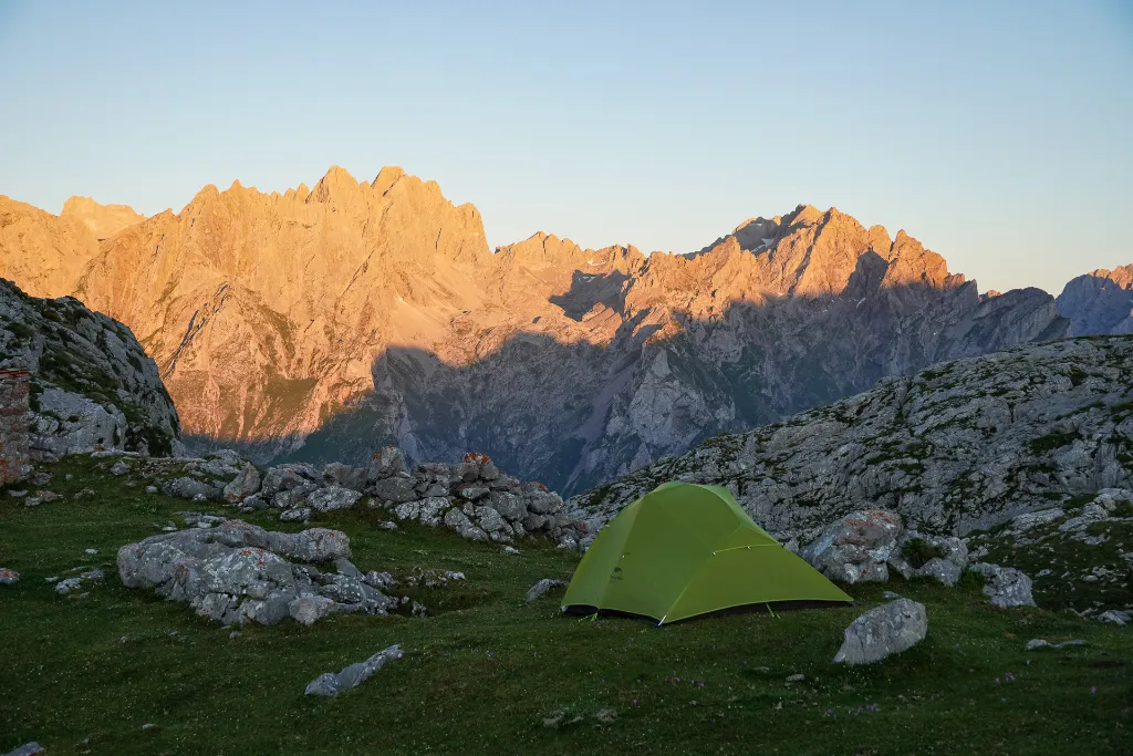
Wild Camping in the Picos de Europa
How to Get to the Trailhead
Exploring northern Spain without a car can be tricky. We rented a car, which gave us a lot of freedom to organize the start and end of the traverse. We chose to start in Poncebos, where we found free parking for several days and an inexpensive hostel to stay in the night before. Other possible starting points are Sotres, Lagos de Covadonga, Posada de Valdeón, and Fuente Dé. The most convenient airport near the region is in the city of Bilbao.
Where to Sleep: Refuges and Camping
The route is designed so that you can sleep in refuges every night if you prefer. Hotel options exist in Posada de Valdeón, Sotres, Bulnes, and Fuente Dé (in the last case, you have to take the cable car down to the village). Reservations for most refuges can be made through this link: reservarefugios.com
We preferred to camp most nights, and it wasn’t difficult as long as you follow a few rules: camping is only allowed above 1,800 meters (about 5,900 feet) in elevation, and your tent must be pitched one hour before sunset and taken down within one hour after sunrise.
If you’re planning the details of each stage, it’s worth using the Hike Planner to build your itinerary with real route data, variants, refuges with real-time availability and booking links, plus GPX files you can download to your navigation app.
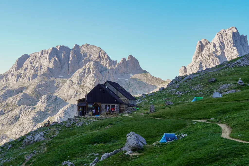
Collado Jermoso Refuge, Picos de Europa
Water and Food
Water is a real concern throughout the entire Anillo de Picos de Europa. Water sources in the higher sections are drying up more and more. At Refugio Vega de Ario, for example, there is a spring outside, but by late afternoon the flow had dropped to just a few drops, and in the morning it was back to normal. Because of this, you can’t rely entirely on natural water sources.
In Posada de Valdeón and Sotres there are small markets where you can buy some supplies. Since we camped most nights, we carried all of our dehydrated food with us. If you sleep in the refuges, dinner and breakfast are already included, and you can usually order a packed lunch as well, which lets you hike with a lighter pack.
Asturian food, and the cuisine of northern Spain as a whole, is a chapter of its own and well worth exploring. Dishes like Fabada and Cachopo are very popular, and the portions are usually quite generous. It’s also worth trying the Asturian cheeses and the cider.
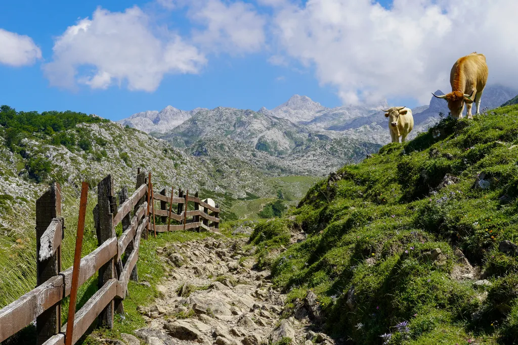
Cows are part of the landscape along the entire traverse
When Is the Best Time to Go?
The best time is summer, from June to September. Some refuges open as early as April and don’t close until the end of October, so shoulder seasons are also possible. Even so, the mountains still have snow in the middle of summer. We did the hike in late July and came across a few snowy sections between Refugio Collado Jermoso and Cabaña Verónica, but nothing that required extra gear or posed much difficulty.
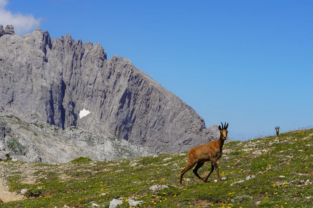
Chamois (rebecos), a kind of goat-antelope native to the region
A Few Practical Tips
- Bring more cash than you think you’ll need. There aren’t many ATMs along the route, and the signal for card payments is very unreliable.
- Don’t rely entirely on natural water sources at altitude. Always carry more water than usual, especially in the higher sections.
- If you’re going to camp, remember the rules: only above 1,800 m (5,900 ft), pitching your tent one hour before sunset and taking it down within one hour after sunrise.
- Be prepared for hot days with a lot of sun exposure. In the summer, this region of Spain can reach very high temperatures, and there are many stretches with no shade at all.
- Pay extra attention so you don’t get lost. Especially on the rockier sections, you always need to look for the paint marks on the rocks and the trail markers.
- Respect grazing areas and livestock. Always keep a safe distance from the animals, especially when there are shepherd dogs nearby.
Where should you start planning?
If you’ve made it this far and you’re excited to take on the Anillo de Picos de Europa, the next step is to put together your itinerary. The Hike Planner is a perfect tool for planning your adventure. What sets it apart is that it maps out all the lodging options, all in one place, with all the contact details and links to make reservations.
The Anillo de Picos de Europa requires physical fitness and technical skill, but with the right planning, it’s one of the most rewarding treks we’ve ever done. Between the rock walls, the green valleys of Asturias, and the chamois crossing the trails, it’s easy to see why this is considered one of the best trekking routes in Spain.
Este post também está disponível em: Português (Portuguese (Brazil))