

The Alta Via 1 is one of the best long-distance trails in Europe. It covers 115 km across the heart of the Dolomites, in northern Italy, a region that was a battleground between the Austro-Hungarian Empire and Italy during World War I, and still bears those marks on the mountains: tunnels carved into the rock, trenches and bunkers that you come across along the way. All of this framed by landscapes with alpine lakes, limestone rock formations, fields full of edelweiss (an alpine flower), and refuges serving some of the best and most authentic Italian food.
This guide brings together practical information on logistics, accommodation, food, when to go, and what to expect from the trail.
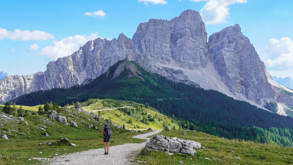
The Dolomites and their pale-colored rock
Alta Via 1 Fact Sheet
- Location: Dolomites, Italy
- Stages: 7-10 days
- Distance: 115 km
- Elevation: 7,200 m gain / 8,200 m loss
- Season: June-September
- Route type: Point to point
- Maximum altitude: 2,752m
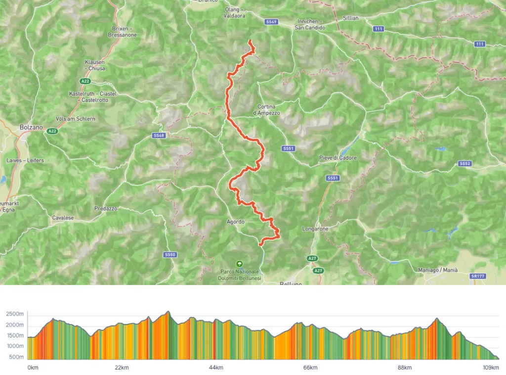
Route overview map taken from the Hike Planner tool
What is the Alta Via 1?
The Alta Via 1 is a long-distance trail that crosses the Dolomites from north to south, connecting Lago di Braies to the town of Belluno. The official route is 115 km long with 7,200 meters of elevation gain. Most people complete the route in 9 to 10 days, which allows for a comfortable pace. The Dolomites are famous for their via ferratas, which can be intimidating for many people and require extra gear. The Alta Via 1, however, doesn’t pass through any via ferrata, which is part of why it’s so popular.
Along the way, you’ll pass remnants of World War I, most notably the tunnels of the Galleria Lagazuoi, dug during the fighting between Italy and Austria-Hungary, where soldiers fought battles at altitudes above 2,500 m and in extreme winter conditions. Today, the tunnels function as a kind of open-air museum, where you can walk through them and find objects and ruins from the battles, all set against breathtaking panoramic views. Certainly one of the most striking places along the route.
Another highlight is the variety of pale-colored limestone mountain formations, which take on shades of red and pink during sunrise and sunset. One of the most iconic formations is the Cinque Torri, a group of 5 imposing rock towers that’s also a popular spot for climbing.
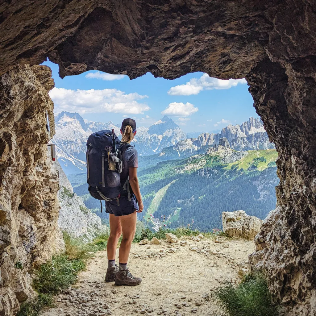
An opening with views inside the Lagazuoi tunnels
How to get to the trailhead?
The most convenient and closest airport is Venice. From there, you can take a bus or train to the start of the trail, depending on whether you want to hike it in the classic direction or in reverse.
Classic direction (North to South, Lago di Braies to Belluno): From Venice, the Cortina Express runs from the airport to Dobbiaco with a transfer in Cortina d’Ampezzo. From Dobbiaco, bus 445 runs frequently to Lago di Braies.
Reverse direction (South to North, Belluno to Lago di Braies): From Venice, a 2-hour train ride gets you to Belluno. From there, a 20-minute bus ride takes you to the La Pissa stop, where the trail begins.
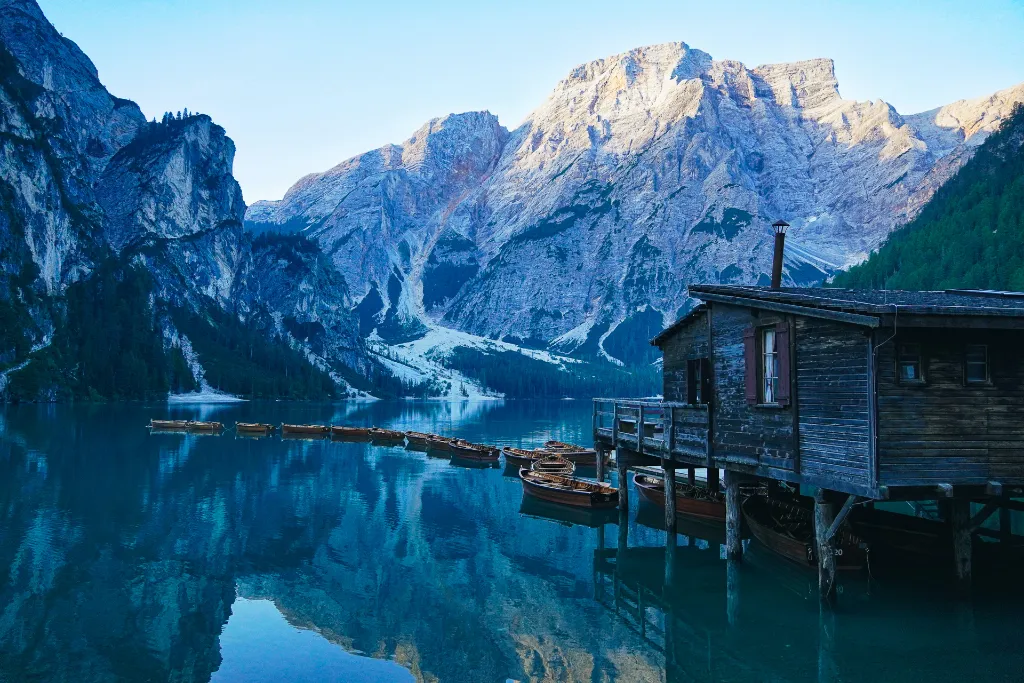
Lago di Braies, one of the postcard sights of the Dolomites
Accommodation: the biggest planning challenge
Rifugios are the most immersive option and, in practice, the only option for most hikers. The Alta Via 1 route stays at high altitude for almost the entire trail. There are no towns, villages, or hotels along the way. This means everyone hiking the trail is competing for the same beds on the same nights. Add to that the fact that there’s only one official campsite along the entire route and wild camping is prohibited, and you can see why booking can be a challenge.
Rifugios vary a lot in terms of comfort. Some, like Rifugio Lavarella and Rifugio Averau, have private rooms, private bathrooms, and even a sauna, more like small mountain hotels. Others, like Rifugio Biella and Rifugio Nuvolau, are more rustic, with shared dormitories and a simple setup.
The food is one of the trail’s best surprises. We expected just pasta, and there is pasta, and it’s good, but what we didn’t expect were homemade pies and desserts, with fresh fruit and artisanal gelato. At the end of the day, an Aperol Spritz with a view of the Dolomites is also a great choice.
When to book: ideally, you should start in September or October of the previous year, especially if you want to go in July or August. Some rifugios open bookings later, in February or April. Keep track of opening dates and be ready to book as soon as they open.
How to book: there’s no centralized system. Each rifugio has its own website and its own system. Most accept online bookings, but some still require email or phone.
A tip: Use the Hike Planner to see all the rifugios along the route in one place, with real-time availability and direct booking links. This makes it much easier to put together an itinerary without having to visit 30 different websites.
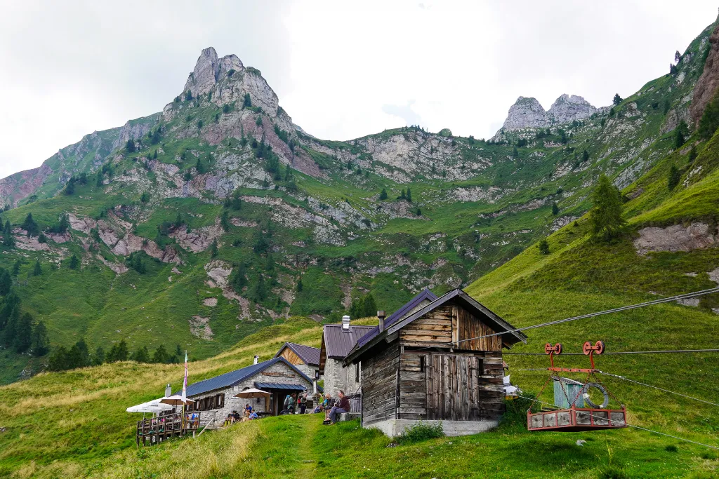
Rifugio Pian de Fontana, and its traditional “cable car” system for bringing supplies to the top of the mountain
How many days do you need to hike the Alta Via 1?
The most common itinerary is 9 to 10 days, with daily stages between 10 and 15 km. For those new to long-distance hiking, this pace is ideal — you get to enjoy the scenery more, rest better, and arrive at each rifugio in better shape. If you have less time, you can combine stages and complete it in 7 or 8 days, but be prepared for some more demanding days.
What’s the best time to go?
The season runs from mid-June to mid-September. Outside that window, trail conditions aren’t reliable and most rifugios will be closed.
Until late June, you can still find some snow on the higher passes. July and August are the busiest months, with a more crowded trail and packed rifugios. Late August and early September offer fewer people on the trail, still-stable weather, and more availability at the rifugios.
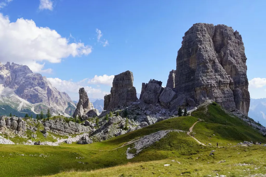
Cinque Torri, one of the most iconic rock formations along the Alta Via 1
A few practical tips
A few things I learned from completing the Alta Via 1:
- Book the rifugios in advance.
Especially in July and August. If you’re going during peak season, you need to start planning well ahead of time. - Get your legs ready for the descents. The climbs are tiring, but it’s the long descents that wreck your knees. Trekking poles help a lot.
- There aren’t many resupply points along the route. Plan all your food before you set off.
- Bring layers. Even in July, nights at high altitude are cold. It’s very important to be well equipped with thermal and rain-resistant clothing.
- Bring a water bottle with a filter. Rifugios let you fill up at the bathroom taps, but they don’t guarantee the water is safe to drink.
- Bring cash. Most places already accept cards, but it’s always good to carry some cash, especially in the high-mountain sections.
Where to start planning?
If you’ve made it this far and you’re excited to hike the Alta Via 1, the next step is putting together your itinerary. The Hike Planner is the perfect tool for planning your adventure. What sets it apart is that it maps out all the accommodation options in one place, with all the contact details and booking links. For rifugios that have an online booking system, you can even see real-time availability right on the map.
The Alta Via 1 requires planning, but it doesn’t have to be complicated. With the right information and the right resources, you’ll arrive in the Dolomites ready to start, and you’ll understand why this trail is considered one of the best in the world.
For anyone who wants a little extra taste of what it’s like to hike the Alta Via 1, here’s a “Silent Hiking” style video with footage of the trail, the rifugios, and camping:
This post is also available in: Português (Portuguese (Brazil)) Español (Spanish)